Our mission is to support the lives and livelihoods of people who share space with elephants while considering the needs of elephants and their habitats.
Founded in 2013 by a multi-disciplinary team, Ecoexist takes a holistic approach to finding practical, affordable, effective and lasting ways for people and elephants to coexist.
In a place of heightened competition for these resources, we strive to find ways for people and elephants to share space by ensuring they are available to both. We address the needs for people to be safe, food secure and gain benefits from living with elephants, while ensuring critical habitat security and safe passage for elephants.
We work on the ground and at policy level to create an enabling environment for coexistence. Developing and facilitating multi-stakeholder partnerships is fundamental to our approach and contributes, alongside awareness, education and policy-level engagement as key contributors to the long-term success of our efforts.
Our approach is evidence-based. All our activities are monitored through on-going research, improving our knowledge of the issues and providing evidence to guide interventions and inform policy. We adapt our interventions and support with lessons learnt, while exchanging these with, and learning from our partners and other practitioners in the field.
What we do
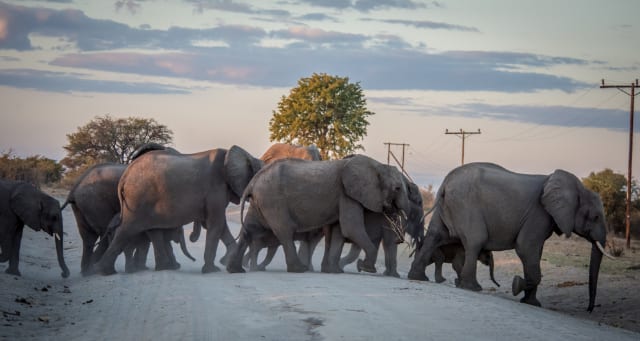
Securing Space
We gather social, biological, and ecological information about people and elephants in the region to develop a big-picture understanding of competition and to help build opportunities for zoning land use and reducing conflicts.
Learn More +
1. Securing Space
"Thinking 50-100 years from now, we would like to have good ways to control elephants. We will know where to put structures and gardens, and we can use methods like chillis for protection. The fields will have no danger and we will have measures to manage conflicts. Even if they have their own space, we will know where the elephants go. It won't be 100%, but we will know the way forward."
Resident in village of Eretsha
Competition between elephants and people is often intensified when land uses overlap and land allocation is haphazard and poorly planned. Conflicting national policies can impede elephant movements while unwittingly putting farmers and their fields in the middle of elephant pathways.
To support more careful land allocation processes that consider elephant corridors, we have gathered lots of social, biological, and ecological information about resource use by people and elephants. With community expert input, we have and continue to map elephant corridors, tracking the patterns of elephant movements and habitat use, adding scientific data from GPS collars we have deployed on over 50 elephants, while also identifying and mapping important human resource use areas and crop lands, to gain a big-picture understanding of human-elephant competition, where these land uses overlap and how we might avoid future land and resource use competition and conflict.
Modelling and mapping elephant movements and habitats as well as areas for human settlements and farming has helped predict potential flashpoints of conflict, while highlighting opportunities for land use allocation with reduced land use conflicts. We have pioneered a system of multi-data, multi-stakeholder, participatory mapping to incorporate elephant corridors into GIS modelling software using an ESRI ArcGIS model: the Land Use Conflict Information System (LUCIS). Working with the land authorities, this tool has been used to guide future arable land allocations that reduce land use conflicts and can help promote coexistence.
See achievements in “Sharing Space” for more information and our resources and social media pages for updates.
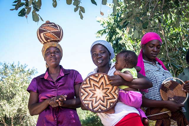
Elephant Economy - Improving and Diversifying Livelihoods because of Elephants
We facilitate private sector support for elephant-friendly, elephant-themed commerce in the Okavango. Through microenterprise development in both the tourism and agriculture value chains, we are creating ways for elephants to signify benefits for people, not just danger and loss, generating an “elephant economy” for improved livelihoods, promoting coexistence (see “Elephant Economy” enterprise website, here)
Learn More +
2. Elephant Economy - Improving and Diversifying Livelihoods because of Elephants
"I'm a the group leader for the Life with Elephants tour, so I and my friends in the group do see benefits from elephants. If we have guests, I'm happy to see elephants."
Leo, from LWE tour group, village of Eretsha
Human-Elephant conflicts can bring a lot of costs to people from chronic stress of living with elephants, through damage to food resources, property and loss of lives. This drives a reduction in tolerance and negative perceptions towards elephants, which can exacerbate the intensity of the conflict. Often, these costs far outweigh the benefits that people derive from living with elephants.
One of our goals is to turn this equation around. We’d like to see people benefitting more from living so close to so many elephants. By supporting start-ups with an elephant-themed product or service, we are creating an “elephant economy” in the Okavango. This entails facilitating communication, reaching out to private sector investors, developing partnerships and creating market linkages for products and services, including community-based, elephant themed tourism experiences.
A Panhandle Cultural Fair has been held on numerous occasions to showcase local cultural arts and products, primarily with elephant themes, identifying talents and products with potential for viable enterprise, while helping market the Panhandle as an elephant-based destination where people live with elephants.
According to government statistics, approximately 80% of livelihoods in the Okavango panhandle rely on subsistence agriculture. We are working hard with subsistence arable farmers to bridge the divide between the wildlife and agriculture sectors, by develoing a value chain for their surplus produce, grown using “elephant aware” practices. We have developed conservation agreements with farmers who practice “Elephant Aware Farming” – farming outside corridors, passively protecting their fields from elephants and practising sustainable agricultural techniques – which is marketed as such and allows them to access markets that gain premium prices for their “Elephant Aware” produce.
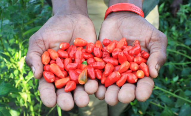
Managing Conflict
We facilitate cooperation among farmers and villages to work and learn together how best to deter elephants from crop-raiding.
Learn More +
3. Managing Conflict
"I tried the chili, dried it, pounded it, and laid it near the field. The elephants changed their path when they smelled it!"
Disho Mongomba, Farmer in village of Gunotsoga
We support farmers and communities to identify, demonstrate and learn best practices to deter elephants from fields and crops and how to be safer around elephants. Though farmers throughout the Panhandle face the day-to-day struggle of protecting their fields from elephants, they often work in isolation of each other. A “Community-Based Conflict Mitigation approach entails a shared responsibility, collective action and exchange of lessons learnt on what does work. It also strives to improve communication and relationships between the government and local communities, part of a strategy to address human-human conflict. It has resulted in a set of effective, affordable, and adaptive tools and techniques to prevent negative interactions with elephants.
Some effective field deterrents range from low-cost tradition methods of drumming and placing tin cans and plastic on fences, to farming and adopting chili pepper fencing and briquettes, and bee-hive fences, to more techniques that require more costly equipment like solar lights, solar electric fences. A multi-layered approached is preferable, targeting most or all of an elephants senses: sight, hearing, smell, touch, and taste. It also includes adapting practices to elephant feeding and movement behaviour, like planting unpalatable crops, earlier in the planting season when there are less elephants around.
Importantly, these mitigation measures are implemented using a landscape approach, avoiding blocking movement corridors and other essential resource use areas, focusing on area or zone-based interventions, like protecting clusters of fields, with more than 100 farmers inside a single fence, which is located away from elephant corridors.
Our work to improve safety for people in their everyday lives has resulted in building partnerships to establish an “Elephant Express” service to assist children and clinic-goers to travel safely across elephant corridors. We also help to build and spread knowledge of how to behave if you see an elephant when you are on foot, using local experts and a collaborative curriculum for education talks in villages and schools.
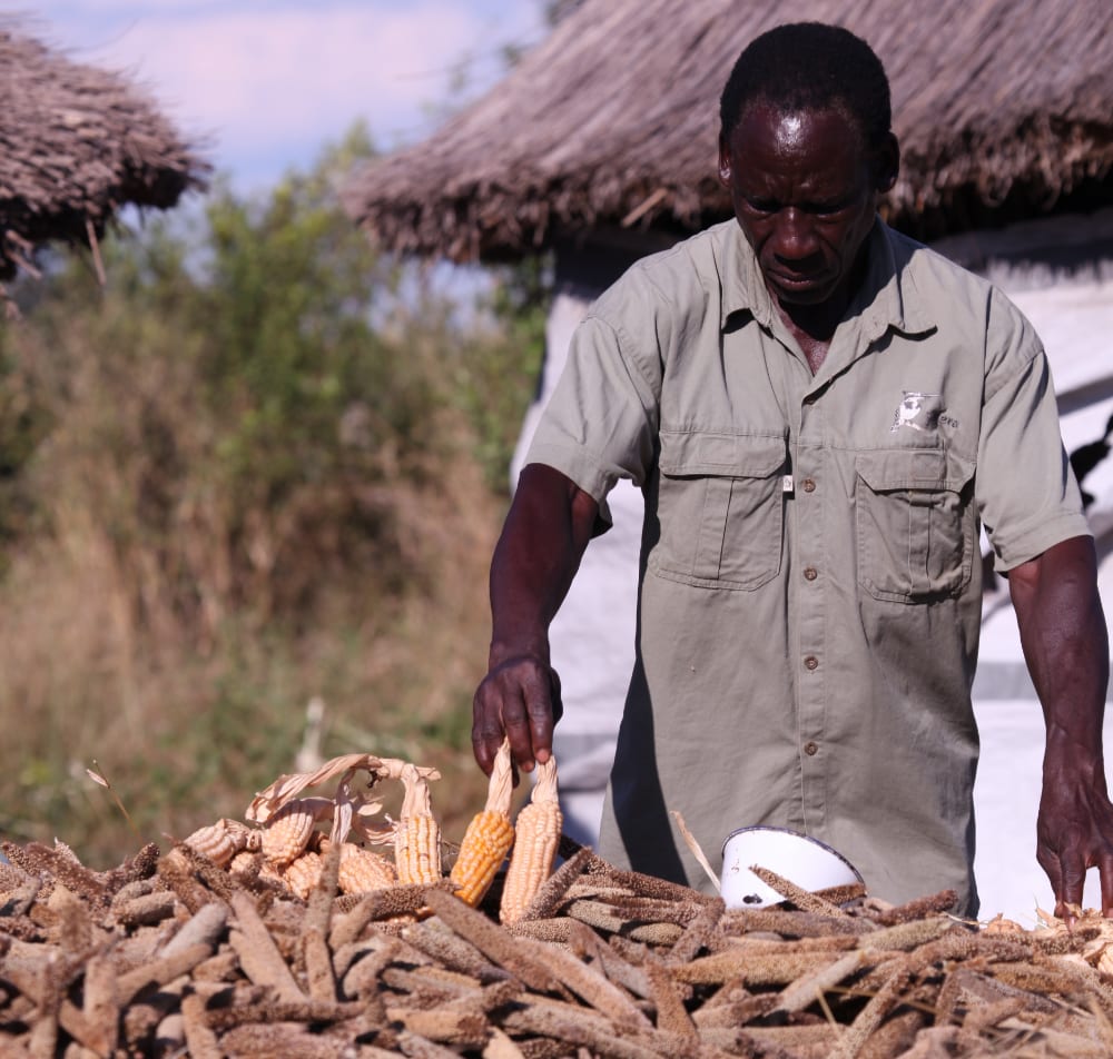
Elephant Aware Farming
We lead collaborative research to help farmers develop more productive, sustainable farming techniques, and more resilient cropping strategies.
Learn More +
4. Elephant Aware Farming
"Some farming systems should disappear, some should remain for the coming generation, and some can help control elephants."
Mosupi Simba, Farmer in village of Gunotsoga
It is a challenge for people to grow crops in the Okavango Panhandle, as a result of the poor Kalahari soils and poor, unpredictable rainfall. As a result, yields are often low. With the extra risk of elephants entering fields and eating their crops, farmers are vulnerable and often fail to harvest enough food to feed their family.
Farming in an area with elephants requires certain adaptations. We feel that such farming practice and behavioural adaptions should be rewarded and farmers adjusting to a life with elephants should be recognized. “Elephant Aware Farming” is a strategy that builds food security among farmers while sharing space and resources with elephants. It encompasses the holistic strategy towards coexistence that Ecoexist has co-designed with communities and other stakeholders – farming outside of elephant corridors to allow them safe passage to critical resources, passively protecting crops in fields from elephants and using sustainable agricultural techniques, such as conservation agriculture, climate-smart agriculture or low-till agriculture.
Farmers are harvesting higher yields on plots that are easier to manage and protect from elephants, reducing the need to expand fields, or adopt ‘slash and burn’ practices in search of fresh soils. Better soils reduce the need to clear more habitat for crops and enable farmers to stay within cluster fields that can be protected from elephants. Higher yields mean farmers are less susceptible to the impacts of partial crop loss by elephants, building a more resilient farming strategy.
Understanding the social-ecological landscape
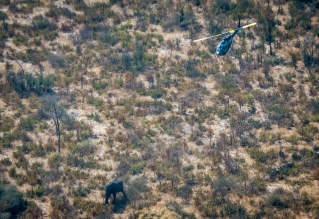
We track elephants to understand their population size and changes over time, their seasonal movements, pathways, preferred habitats, sources of food and water, and their interactions with other elephants and people.
Learn More +
5. Understanding the social-ecological landscape
“The seasonally water-filled pans to the north of the villages are a kind of “Elephant Paradise.”
Ecoexist CEO, Dr. Anna Songhurst
Human wildlife conflict is complex and requires an understanding of both the people and animals, and the multiple aspects factors that influence it. It requires understanding factors and people involved from multiple sectors and disciplines, and is influenced by social, biological, political, economical, and cultural elements!
Since our inception, Ecoexist has adopted a multi-disciplinary research programme, collaborating with numerous academic institutions, across different sectors to unravel some of the complexities to human elephant conflict in the Okavango Delta, with a focus on providing more evidence to inform solution design and implementation. Research topics include a broad range of topics, with state of the art multi-disciplinary approaches, incorporating ecological, biological, social, economic and political multi-disciplinary approaches and analysis: how best to monitor human-elephant conflict incidents data and understand what socio-ecological factors contribute as drivers of conflict; monitoring elephant movements and understanding the socio-ecological factors influencing them; understanding the socio-economic impact and opportunities of living with elephants; investigating the overlap in resource use between people and elephants and how to predict land use conflicts in multiple-use, social-ecological landscapes; testing various elephant deterrents and the ecological, social and political factors influencing their adoption and success; monitoring the role of different agricultural techniques and cropping strategies in reducing conflict; gaining an understanding of how people are adapting to a life a with elephants; investigating the role of institutions in managing conflict; conducting aerial surveys to monitor elephant population numbers and trends, and; understanding the feeding ecology of elephants and how it influences crop raiding behaviour.
Everything we do at Ecoexist is about finding ways for people and elephants to share space. We think about conflict and coexistence from many different angles. We focus on long-term planning and short-term interventions. We think about the needs of farmers at home and in their crop fields and we think about the needs of elephants and how they need to move across vast spaces and habitats. We strive to understand how people are living, what their aspirations and concerns are, what they need now and what they dream of for their children. And we strive to understand where, when, and how elephants are moving, what their feeding, drinking and movement patterns and behaviours are, and how their population is changing. We listen to people and, as best we can, we listen to elephants.
See updates on our work on our resources and social media pages.